 |

About Boone County, Indiana, USA
|
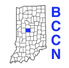
Boone County has a population of approximately 50,000 (2004 estimate from U.S. Census Bureau) residents and is located approximately 25 miles northwest of Indianapolis. The population is growing as businesses locate in an area close to major interstates, and newcomers select the area as a residential site and work in the nearby cities of Indianapolis and Lafayette.
The two largest communities are Lebanon and Zionsville. Lebanon, the county seat, is known for its beautiful courthouse square and the "Back to the 50s" festival held in the Fall. Zionsville is located in the rapidly growing southeast portion of the county and is famous for its quaint village-like atmosphere, shops, and brick main street.
Other incorporated communities in Boone County are: Advance, Jamestown, Thorntown, Ulen, and Whitestown.
History:
History of Boone County from Boone County Tourism site, or from the Boone County INGenWeb site (with township history information), or from the Boone County page of the Local Indiana History site.
Boone County Vital statistics At A Glance:
- County seat: Lebanon
- Government: 7 member County Council and 3 member Board of Commissioners
- Size: 420.1 square miles (268,000 acres)
- Population Estimate: 2004 population estimate is 50,847 (from US Census Bureau)
- Elevation: 792 feet above sea level
- Established: 1831
- Libraries: 4
- Hospitals - Witham Memorial Hospital in Lebanon, with offices also in Jamestown, and Zionsville.
- Business Information
- Hotels and Accommodations
- Townships: 12 (Center, Clinton, Eagle, Harrison, Jefferson, Jackson, Marion, Perry, Sugar Creek, Union, Washington, Worth)
- Incorporated Communities : 7
- Airports in or near Boone County
- Interstates:
- I-65 - Northwest to Chicago and southeast to Indianapolis
- I-74 - Southeast to Indianapolis and northwest to Crawfordsville
- State Roads:
- S.R. 32 - West to Crawfordsville and east to Noblesville
- S.R. 38 - North to Frankfort and southeast to Sheridan and Noblesville
- S.R. 39 - North to Frankfort and south to Danville
- S.R. 47 - West to Crawfordsville and east to Sheridan
- S.R. 267 - South to Brownsburg and Plainfield
- S.R. 334 - East to Zionsville
- U.S. Roads:
- U.S. 52 - Northwest to Lafayette and southeast to Indianapolis
- U.S. 421 - South to Indianapolis and north to Logansport
[BCCN | About BCCN | By-Laws | Membership & Fees | Acceptable Use Policy | Minutes | Board of Directors]
This page maintained by
of BCCN.

